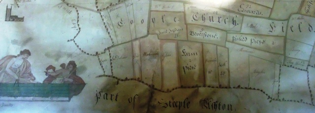
Land Surveyor James Sartain produced the map above of the Estate of Thomas Beach Esq. in 1749. The indication that an ancient church once stood between Keevil and Steeple Ashton, within the parish of Keevil, is reflected in the original ‘open field’ name (shown sub-divided into smaller tenancies). One hundred and sixty four years after the map’s creation, somewhere in the “Coople Church Field” area, a farmer’s plough unearthed an encaustic (inlaid) tile, and struck the foundations of a building.
Categories
- 18th Century (1)
- 19th Century (2)
- 20th Century (4)
- Architecture (1)
- Church (2)
- Family (2)
- Farming (1)
- Fashion (1)
- General posts (1)
- Homes (1)
- Uncategorized (3)
- War (1)
- Women (2)
- Working (1)

